tags:
planetskier |planetcaver |
Orivesi, Finland |
surveying |planetskier |planetcaver |orivesi |lidar |jari arkko |iphone 12 pro |finland |caving |cave |3d
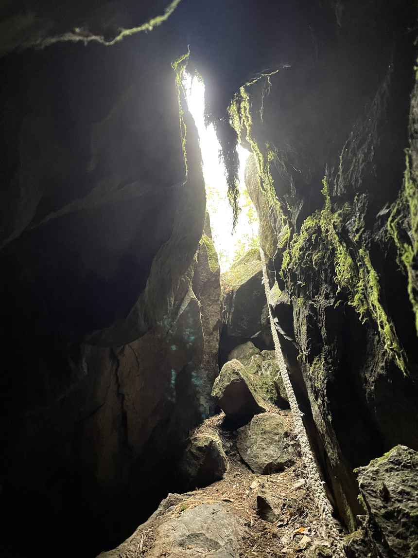
Why look for limestone caves and stalactites, when in Finland you can find moss-stalactites? And besides stalactites, the Kipontien luola (cave of the scoop road) is an exceptionally nice experience. Most Finnish caves are cracks on a cliff or space under boulders. But Kipontie is a hole in the ground, on a more or less level surface, even if inside you can see that it is made up of cracks and boulders. But it is dark, it is tight, actually make that very tight, and downright claustrophobia inducing hell hole. Just like caves should be!
Oddly enough, there hasn't been that much stories about this cave, I have not been there even if it is close to my summer cottage, nothing in Retkipaikka that I can find, and I have not heard about it in the Finnish Caving Association's discussions. In my mind this cave is such a challenging caving experience, dark, and long enough to warrant being compared to Turku's Luolavuoren luola (cave of the cave hill :-) ) or Finland's major karst cave, Torholan luola (cave of Torhola) in Lohja.
But yay, a few years ago Seikkailun lumous made a map of this cave [1]. Very nice! That map is further down in this article, but I used my 3D phone scanner to construct a new map. It is not easy to get a high-quality scan in very tight places, but I managed to get enough to run the model through my map generator, and got this:
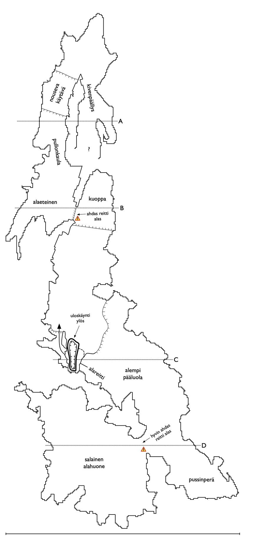
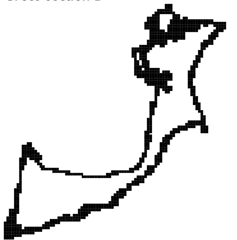
Based on the model, I also calculated that the cave is about 35 meters long, all parts considered. There's also cross sections in my map, such as this one about the Kuoppa (hole) in where the left passage of the cave goes down through a tight spot:
To make the model, we did crawl as far as one can to the cave, although I did not go to the Salainen alahuone (secret lower room) on the left side passage, the entrance to the room was too scary and tight. But my son did, so the 3D model is relatively complete.
The full map in PDF ishere. The 3D model can be downloaded here or rotated on your screenhere.
The cave is in Orivesi, and about 45 minutes drive from Tampere. The coordinates are N 61.685539 E 24.257283.
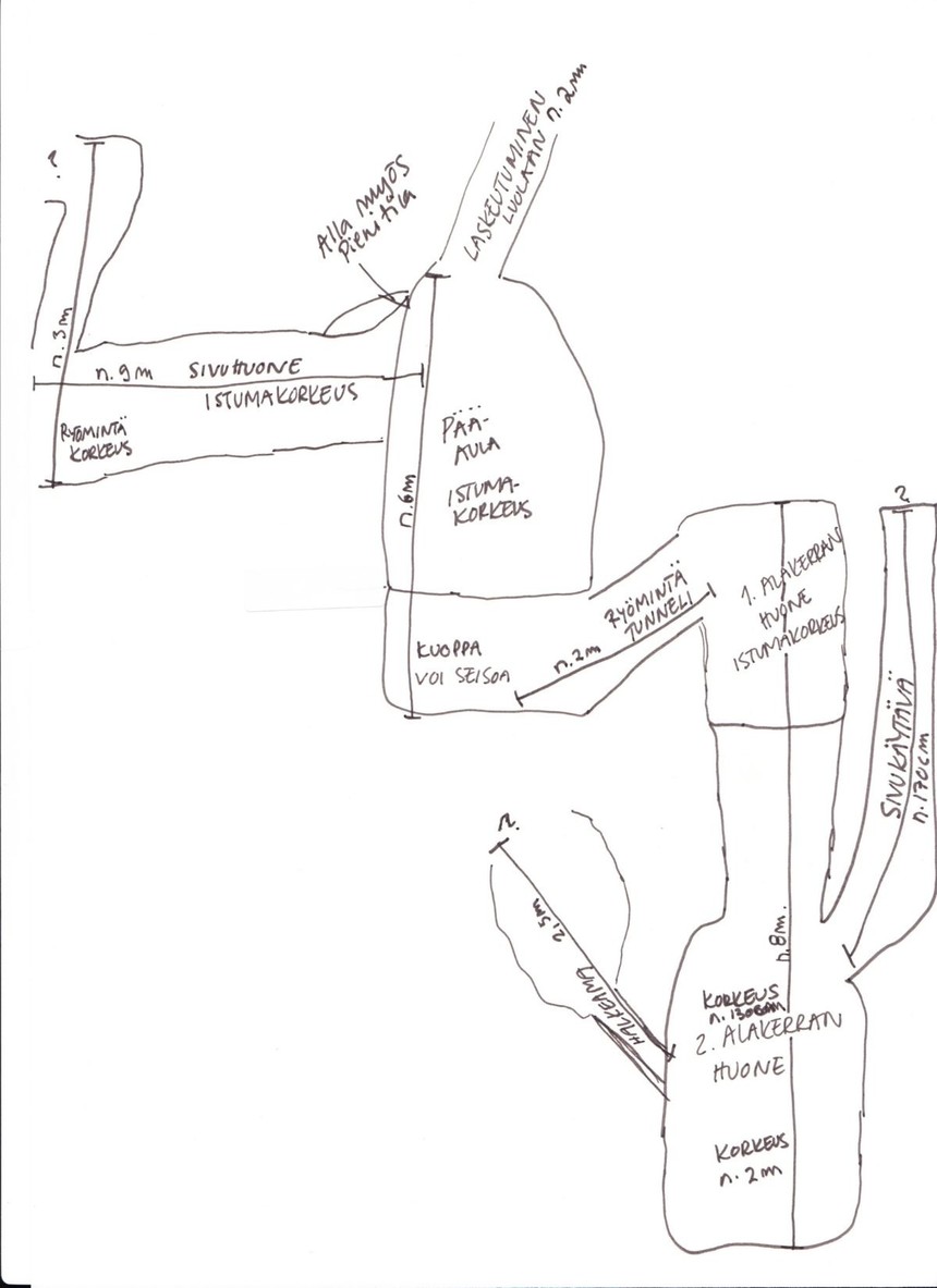
Here's by the way the Seikkailun lumous map, made by hand from measurements. I can't fully explain the difference to my map. I should note that the 3D scanner and softwares are quite experimental, and often seem to make mistakes or produce shadow results. But I also think that we covered bigger part of the cave. It is possible that some of the side passages either in the below map or our map are also errors. And since I have to for now construct the 3D model in parts, I can easily introduce alignment errors where the cave parts are not in the right angle against each other.
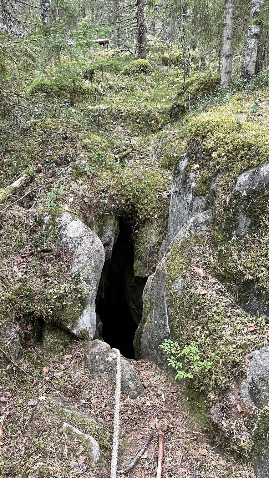
More pictures, first about the entrance:
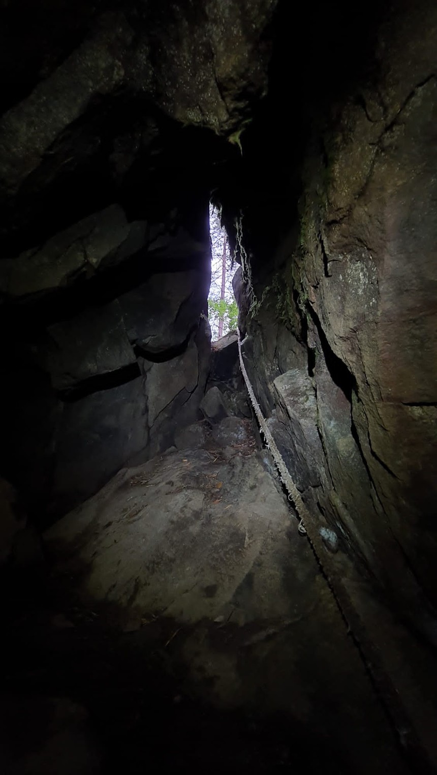
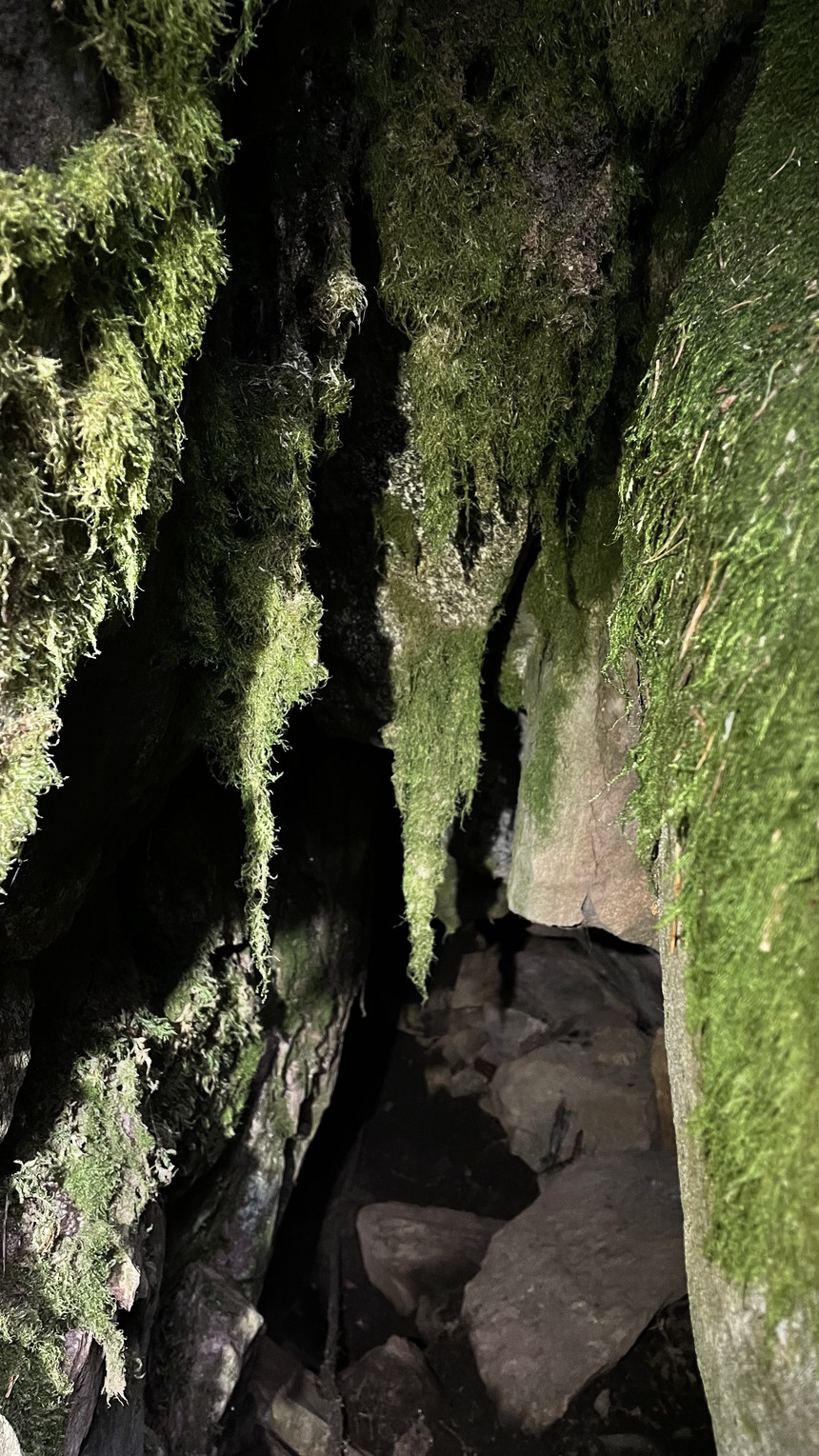
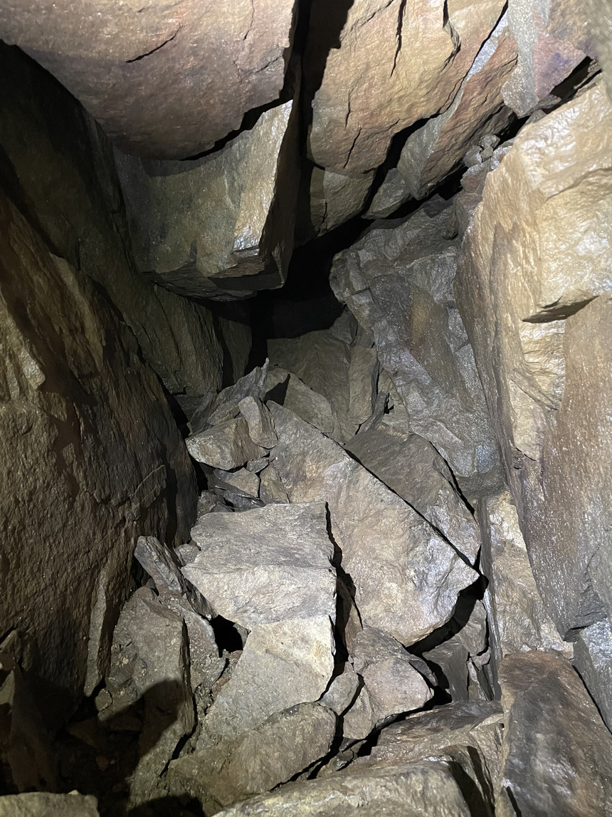
An inside view, from the left passage and the Nouseva käytävä (rising passage):
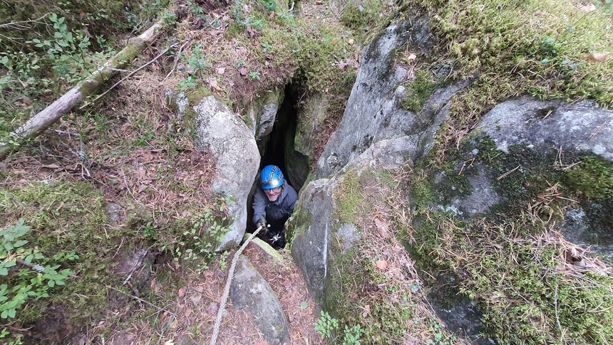
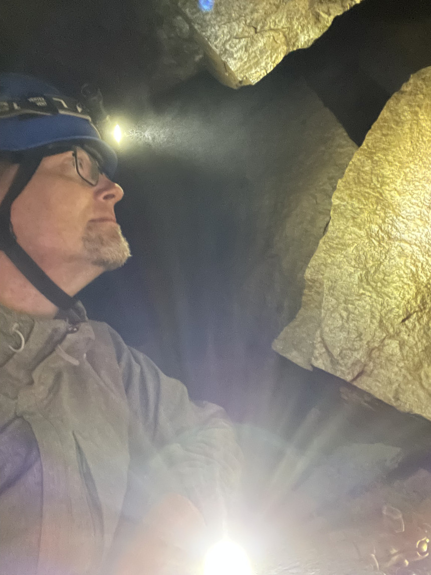
The author, apparently looking for gold?
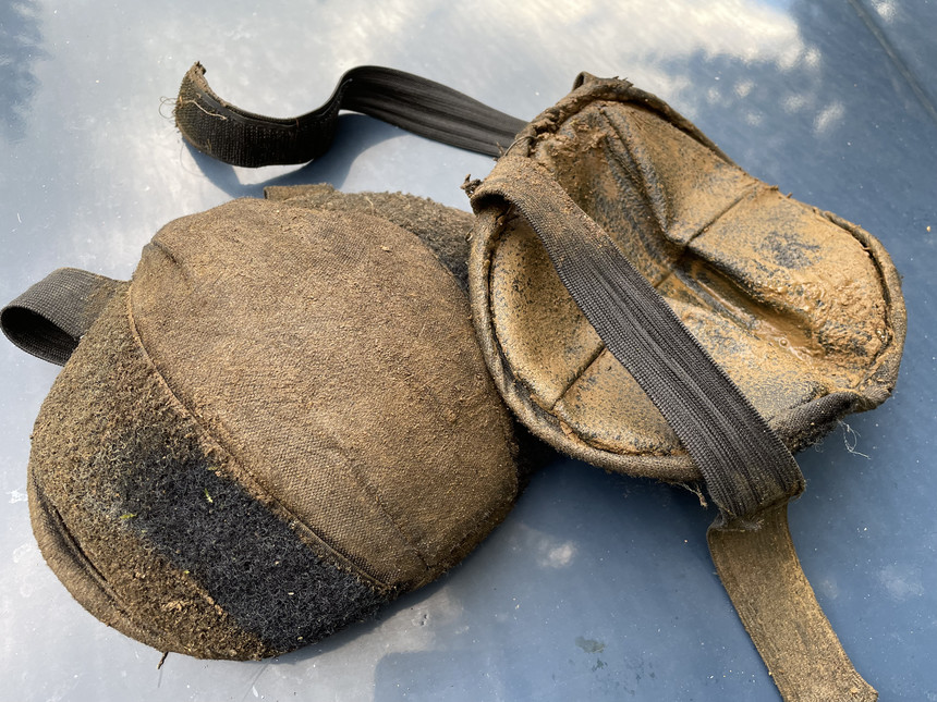
This is how kneepads should look like after caving:
References:
[1] Seikkailun lumous. Kipontien luola. Suomen luolaseura.Luolaseura.fi.
This article has also appeared in Blogspot. Read more urban exploration stories from theurbanexplorer.net, and other underground stories from planetcaver.net. Read the full Planetskier series at planetskier.net, or all blog articles from Blogspot or TGR. The Cave Outliner software is open source and available on GitHub. Photos, videos, models, maps, and text (c) 2022 by Jari and Janne Arkko. The Seikkailun lumous map is obviously from Seikkailun lumous and Suomen luolaseura. All rights reserved.